


Beschreibung
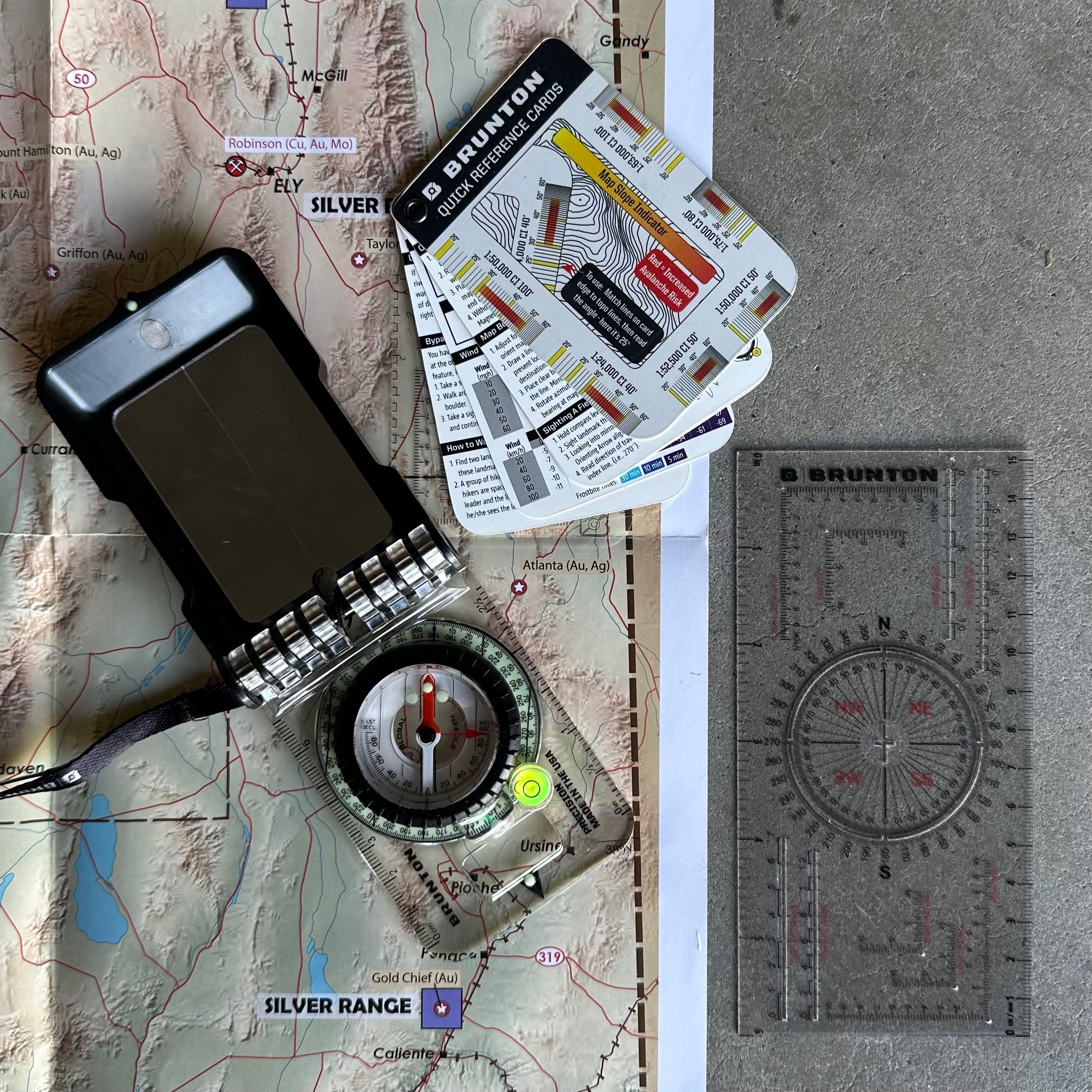
Brunton Navigation Kit
The Brunton Navigation Kit brings together three precision navigation tools: a sighting compass, a mapping tool, and a reference card set. Designed for professionals working in forestry, surveying, fire operations, search and rescue, and back-country fieldwork, this kit supports reliable mapping and route-finding in challenging environments. With a premium baseplate compass, a versatile map multi-tool and durable reference cards, you’ll have what you need for accurate navigation in the field.
What’s Inside
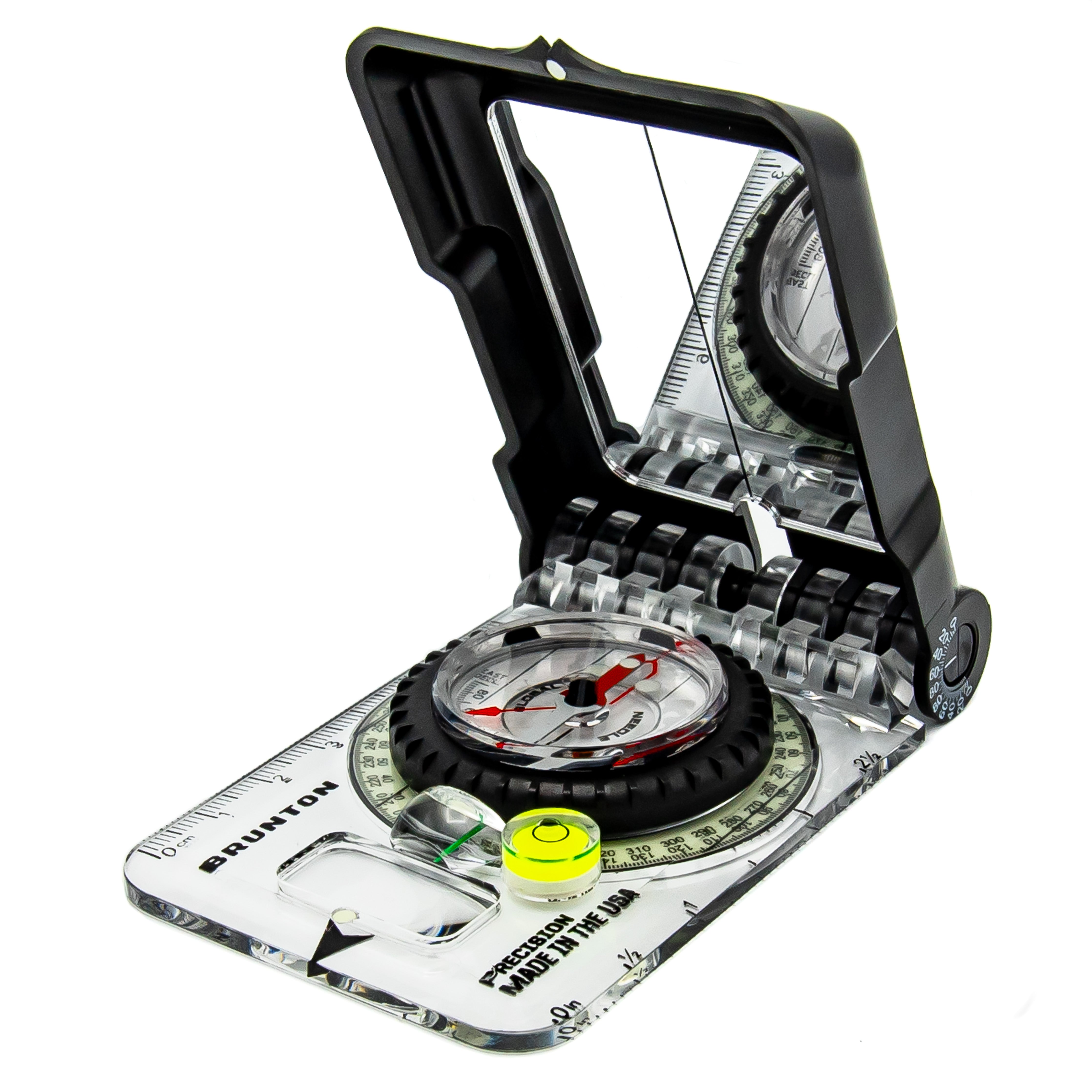
Brunton TruArc 15 Glow Compass
A professional-grade sighting compass built for precise navigation across terrain. The TruArc 15 features a global-balanced needle, sighting mirror, tool-free declination adjustment, integrated clinometer and glow markings for low-light visibility. Its rugged, ergonomic baseplate makes it a trusted instrument for demanding field use.
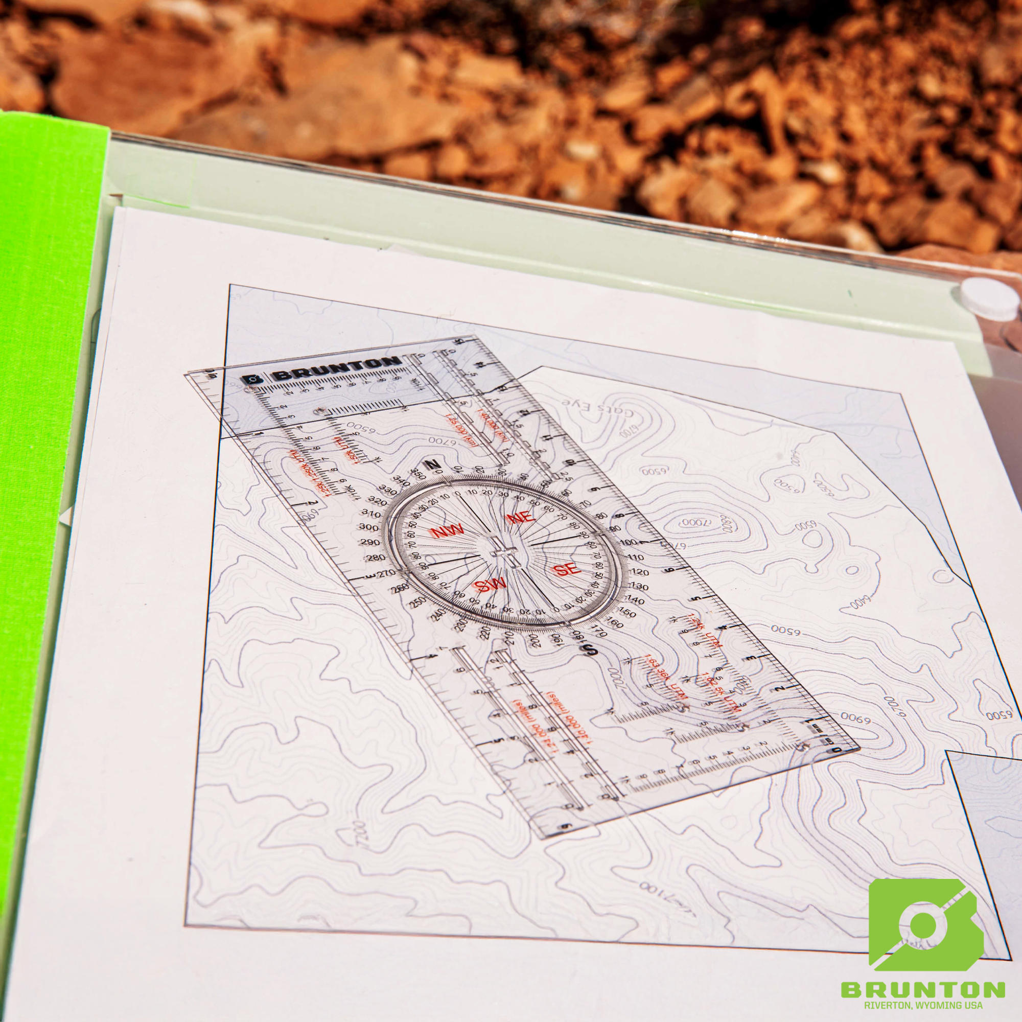
Brunton Map Tool
A durable, multipurpose map tool that includes rulers, map scales, UTM/Romer grids, a full 360° protractor and cut-outs for accurate plotting. Lightweight and easy to use, it supports efficient route planning and on-the-map navigation.
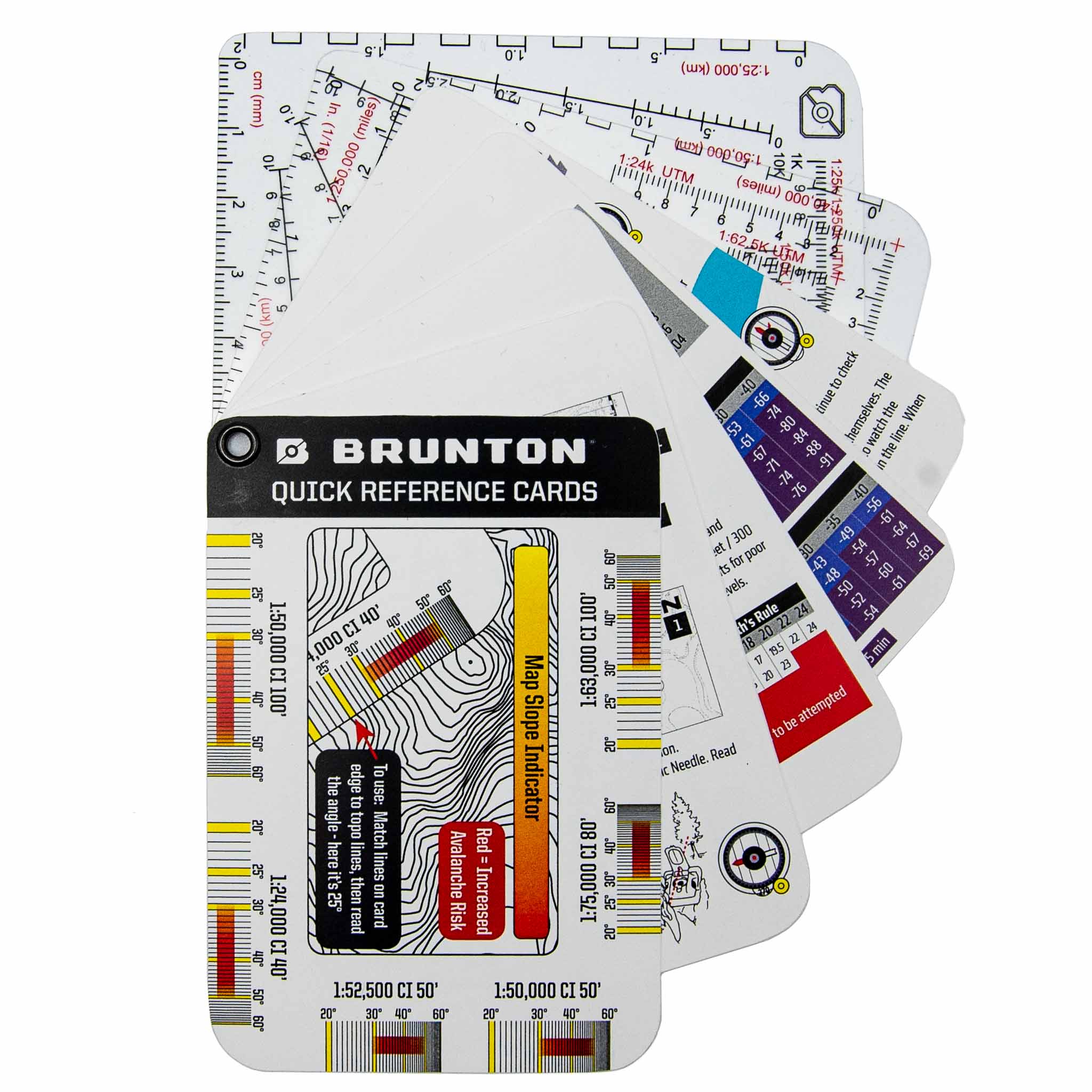
Brunton Reference Card Set
A compact set of waterproof navigation reference cards containing essential tips, techniques and quick-look information for bearing use, map orientation, triangulation and UTM grid work. Pocket-sized, field-resistant and easy to clip onto gear.
Why This Kit?
The Brunton Navigation Kit consolidates the core tools needed for reliable and accurate land navigation. Whether navigating dense forest, mountainous terrain or grid-based maps, this kit provides the clarity and confidence required for field professionals.
Ideal for:
• Forestry and natural resource work
• Search and rescue operations
• Bushfire and incident management
• Outdoor leadership and education
• Back-country expeditions
• Map-and-compass training
Specifications
Brunton TruArc 15 Glow Compass
-
Dimensions: 10.16 × 6.3 × 1.5 cm
-
Weight: 68 g
-
Azimuth resolution: 1°
-
Global needle balanced for worldwide use
-
Tool-free declination adjustment
-
Sighting mirror for accurate bearing alignment
-
Integrated clinometer for slope and height estimation
-
Glow-in-the-dark azimuth ring and indicators
-
Includes bubble level and map magnifier
Brunton Map Tool
-
Dimensions: 15.2 × 7.6 × 0.7 cm
-
Weight: 11 g
-
Includes multiple map scales
-
Metric and imperial rulers
-
UTM/Romer grid overlays
-
360° protractor
-
Lightweight, waterproof and field-durable design
Brunton Reference Card Set
-
Dimensions: 6.4 × 9.3 × 0.2 cm
-
Weight: approximately 12 g
-
Waterproof and tear-resistant construction
-
Includes navigation reference information
-
Covers bearings, map orientation, triangulation, UTM usage and basic field techniques
-
Compact, pocket-ready format
Versandkosten berechnen