


Beschreibung
Garmin eTrex Touch Handheld GPS
Rugged Touchscreen GPS for Real-World Adventure
Tap into adventure with the Garmin eTrex Touch — a new generation of GPS handhelds built for Australia and New Zealand’s toughest terrain. Compact, intuitive and weather-ready, this easy-to-use device features a bright 3" colour touchscreen, preloaded TopoActive maps, and exceptional battery life, making it the perfect companion for bushwalkers, cyclists, 4WD explorers and geocachers alike.
With a rugged IP67-rated design, multi-band GNSS accuracy, and seamless connectivity through Garmin Explore™, the eTrex Touch helps you plan, navigate and share every step of your journey — whether you’re hiking the Larapinta, camping in the Grampians or mapping a new off-road route.
Built Tough, Designed to Explore
The eTrex Touch has been purpose-built to handle the elements. Its durable construction meets MIL-STD-810 impact standards, and the chemically strengthened glass lens resists scratches and bumps. The device is fully dustproof and water-resistant to IP67, so it can handle rain, mud and the occasional creek crossing.
Despite its toughness, it remains slim and lightweight — just 150 grams — fitting comfortably in your pocket or pack.
Brilliant 3" Touchscreen
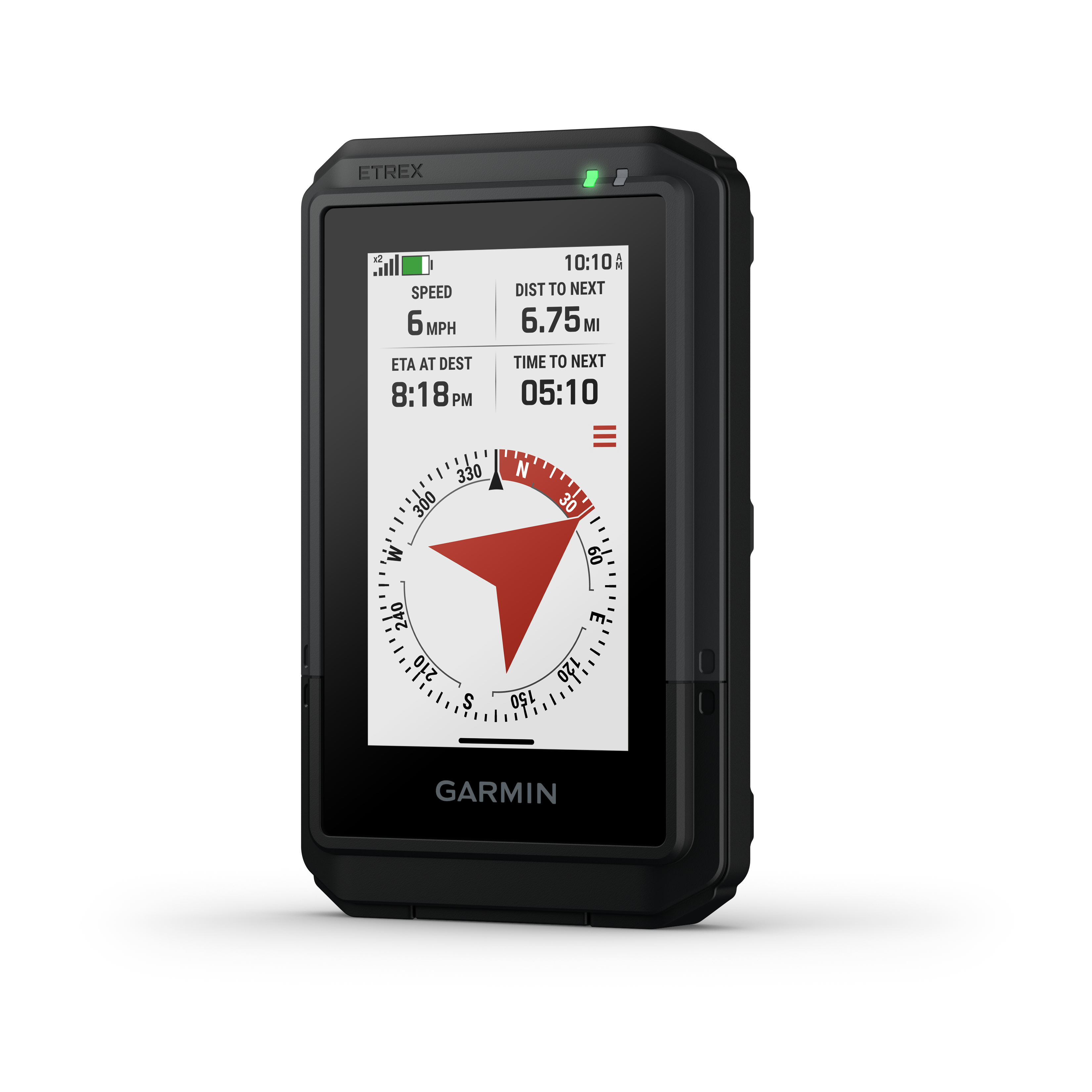
The high-resolution 3-inch colour touchscreen delivers crystal-clear map detail and remains readable under bright Australian sunlight. The interface has been completely redesigned for better usability, allowing you to swipe, pinch and zoom effortlessly while on the move.
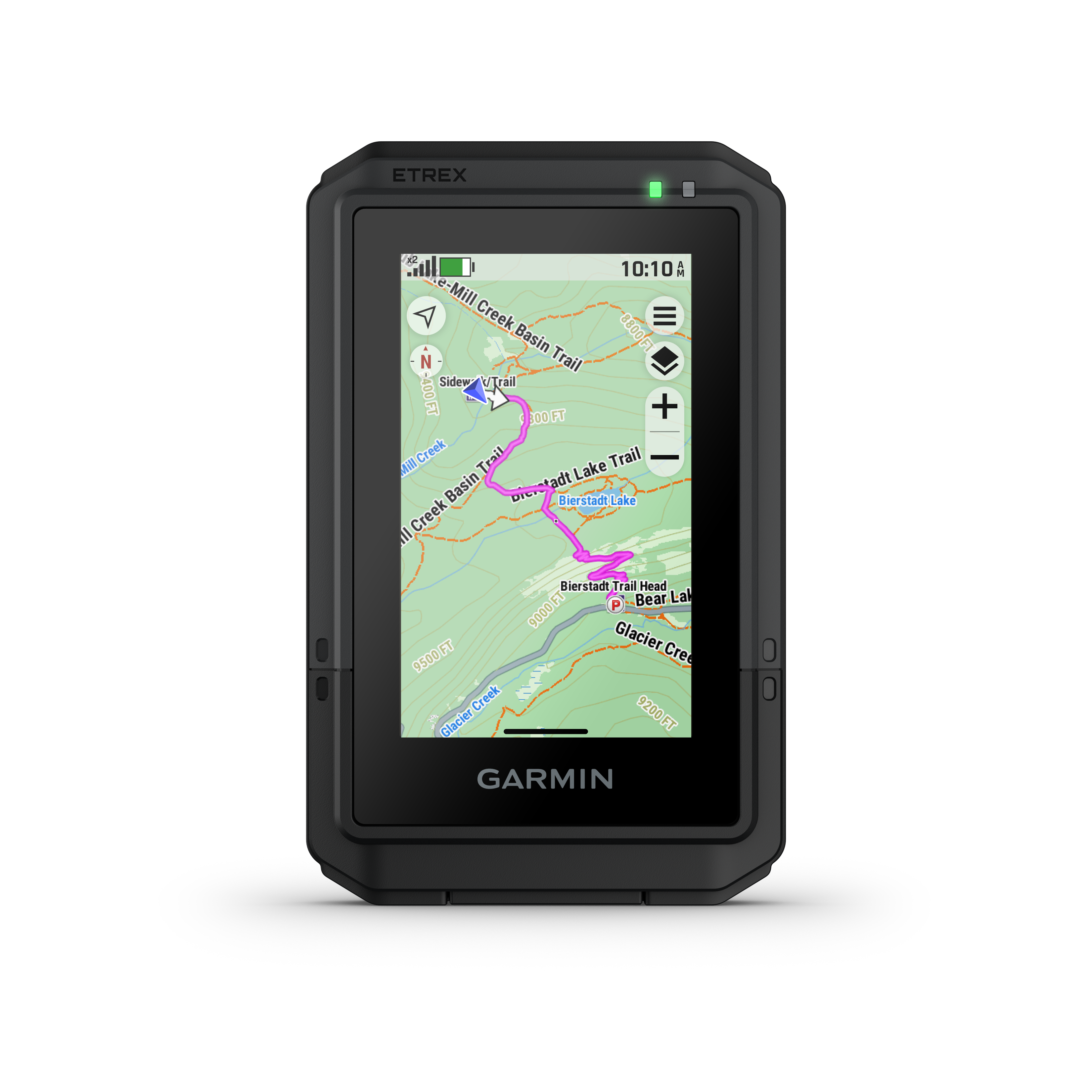
Maps That Move With You
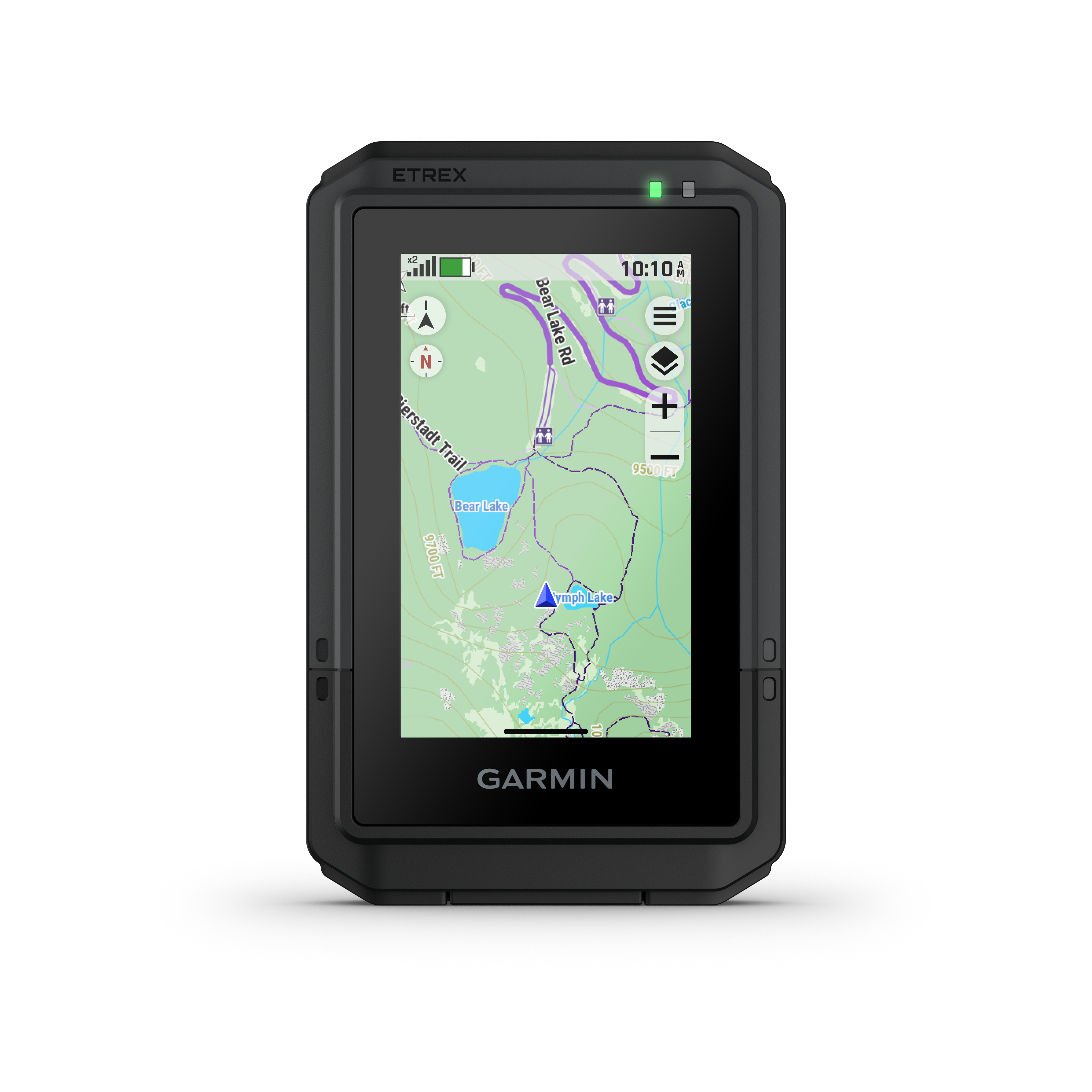
Out of the box, the eTrex Touch comes with preloaded TopoActive maps for Australia and New Zealand. You’ll see roads, trails, topographic contours, rivers, coastlines, parks and thousands of points of interest — from campgrounds and lookouts to picnic sites and summits.
You can expand your mapping with an optional Outdoor Maps+ subscription, giving you premium access to satellite imagery, updated topographic detail and additional map layers delivered automatically via Wi-Fi®.
Precision Navigation in Any Environment
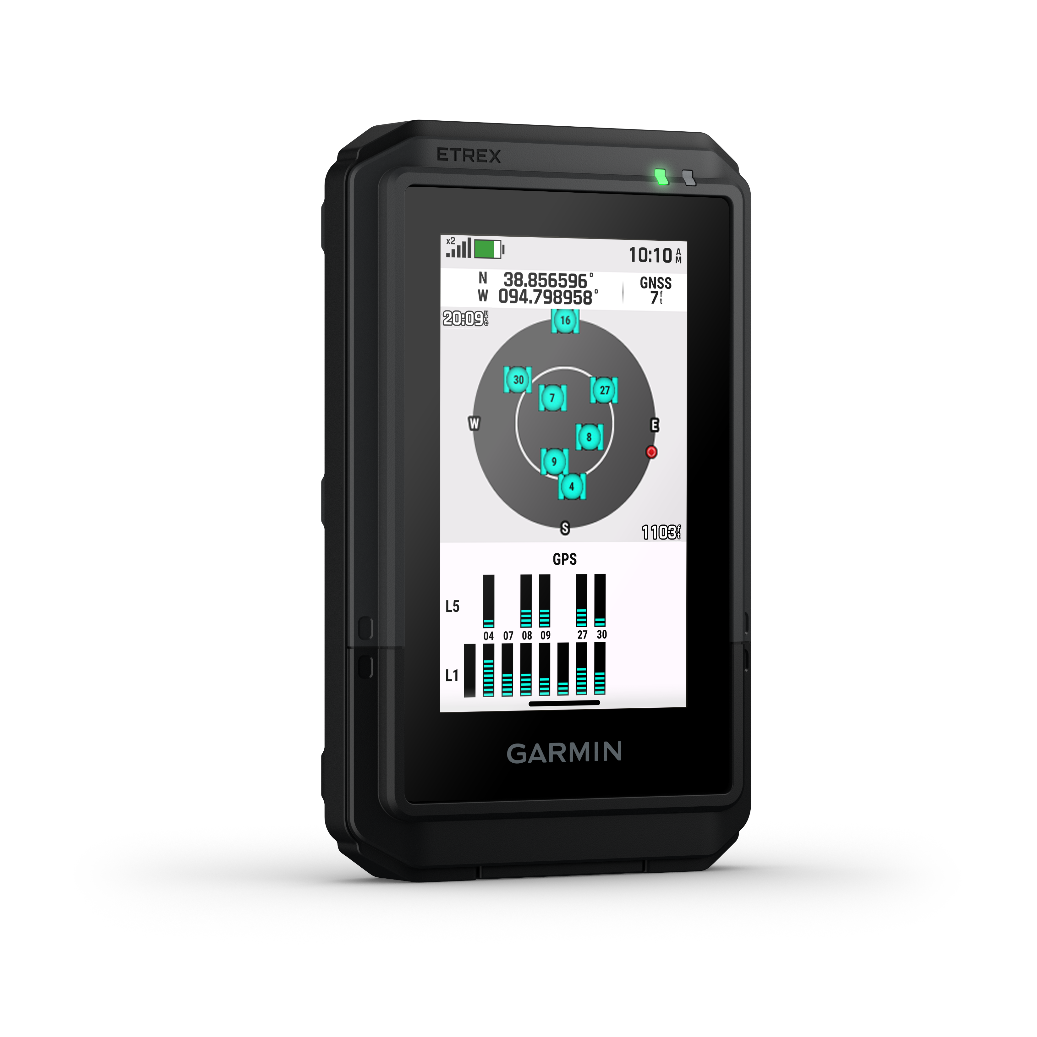
The eTrex Touch supports multi-band GPS and multi-GNSS (GPS, GLONASS, Galileo, QZSS, BeiDou and IRNSS), allowing it to access multiple satellite frequencies for superior accuracy — even under heavy canopy or in deep valleys.
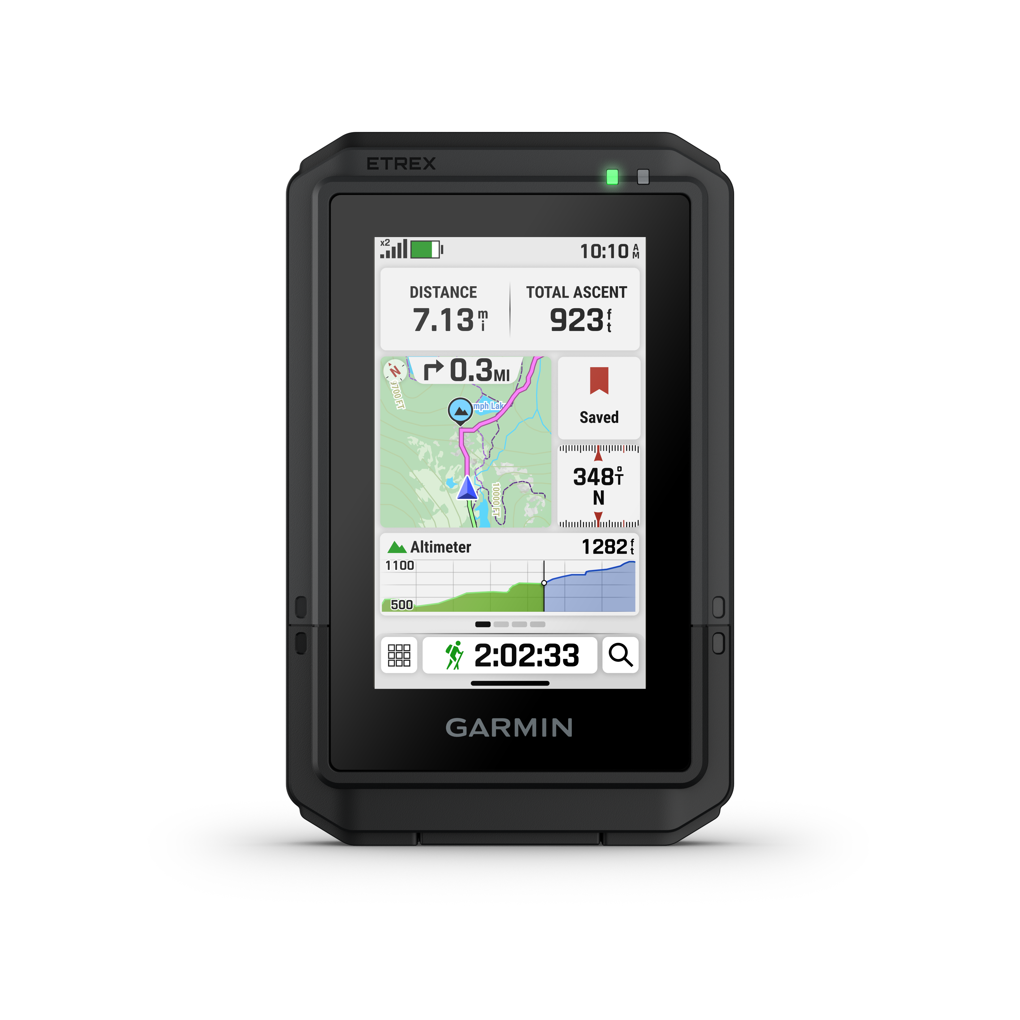
A barometric altimeter tracks elevation changes, while the digital compass keeps you oriented even when stationary. For outdoor professionals and explorers, this combination ensures you always know exactly where you are and where you’re heading.
Smarter Planning and Sharing
Use the Garmin Explore™ mobile app to plan routes, manage waypoints and review trip data. Sync via Bluetooth® or Wi-Fi® to see your activity on a map, track your progress, or view climb profiles with ascent planning tools.
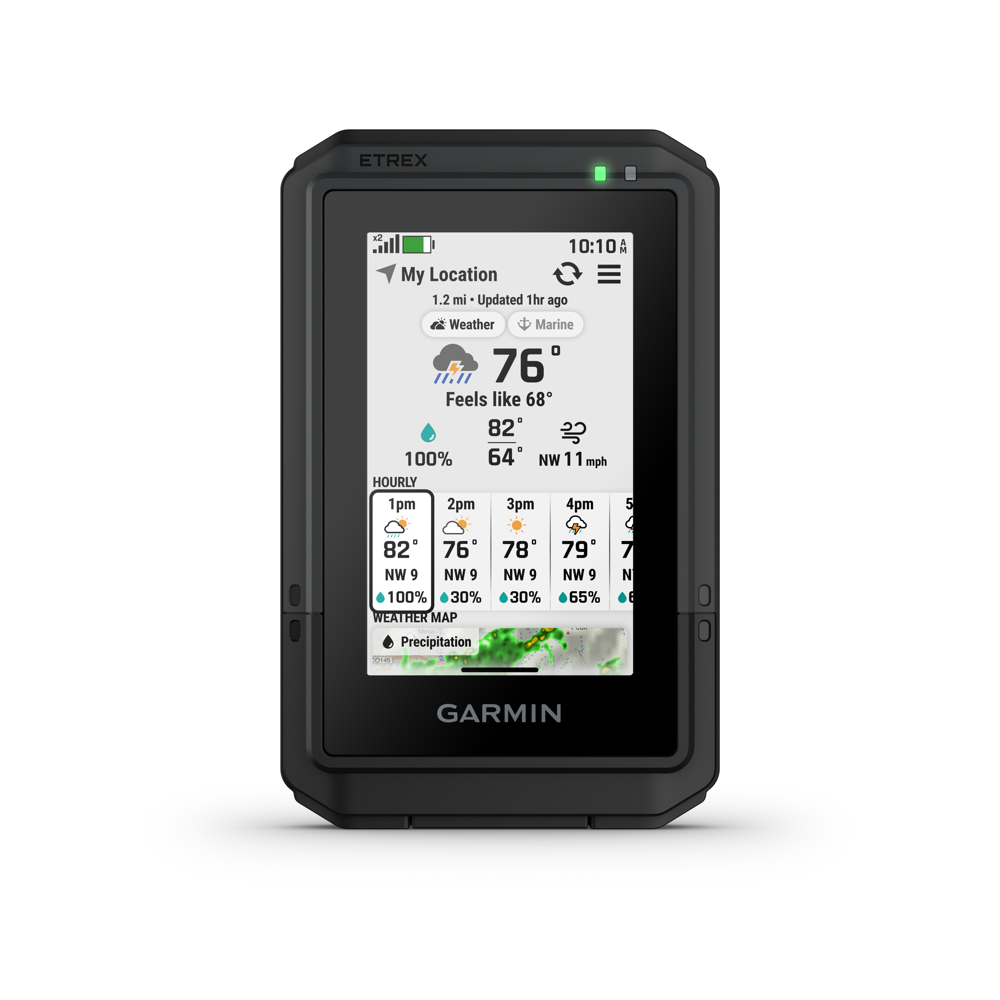
With Garmin Share, you can easily send your saved locations and courses to friends’ compatible Garmin devices. And when connected to your smartphone, the device can display weather forecasts and updates in real time — helping you stay ahead of changing conditions.
Adventure Features That Matter
-
Battery life: Up to 130 hours in GPS + multi-band mode, or 650 hours in expedition mode
-
Accuracy: Multi-band GNSS with SatIQ™ for intelligent power and precision balance
-
Routing: Popularity routing to find the best-rated trails; round-trip routing for custom distance adventures
-
Climb data: Ascent planning shows upcoming gradients and elevation changes
-
Geocaching Live: Automatic cache updates with logs, descriptions and hints
-
Connectivity: Wi-Fi®, Bluetooth® and ANT+®
-
Interface: USB-C charging and data transfer
-
Mounting: Integrated Spine Mount 2 system for bikes, packs and vehicles
Technical Specifications
| Feature | Detail |
|---|---|
| Dimensions | 66 × 105.4 × 24.6 mm |
| Weight | 150 g |
| Display | 3.0″ transflective colour TFT, 240 × 400 pixels |
| Water Rating | IP67 (dust- and water-resistant) |
| Battery Type | Rechargeable internal lithium-ion |
| Battery Life | 130 hrs (GPS + multi-band) / 650 hrs (expedition) |
| Memory | 32 GB internal, user-accessible space varies |
| Interface | USB-C |
| Lens | Chemically strengthened glass |
| GNSS Systems | GPS, GLONASS, Galileo, QZSS, BeiDou, IRNSS |
| Sensors | Barometric altimeter, digital compass |
| Connectivity | Wi-Fi®, Bluetooth®, ANT+® |
| Mapping | Preloaded TopoActive maps, Outdoor Maps+ compatible |
| Software | Garmin Explore™, Garmin Connect IQ™ compatible |
In the Box
-
Garmin eTrex Touch GPS Handheld
-
USB-C charging/data cable
-
Documentation
Versandkosten berechnen