


Description
Brunton Map Multi-Tool
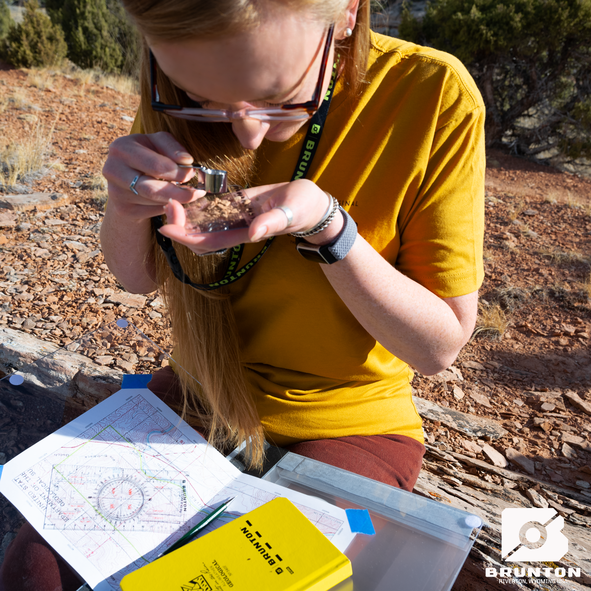
The Ultimate All-in-One Mapping Companion
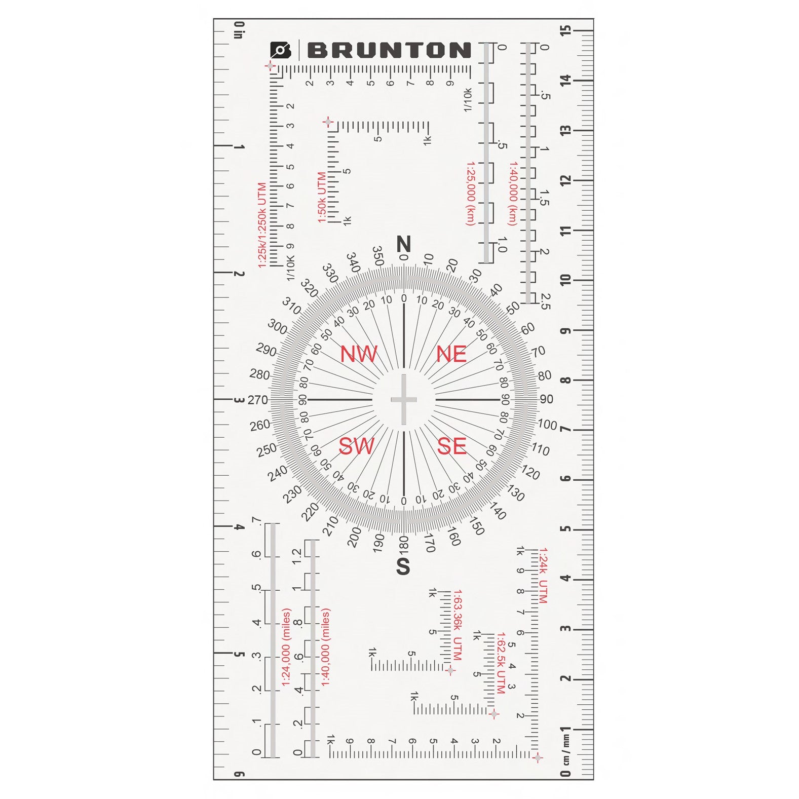
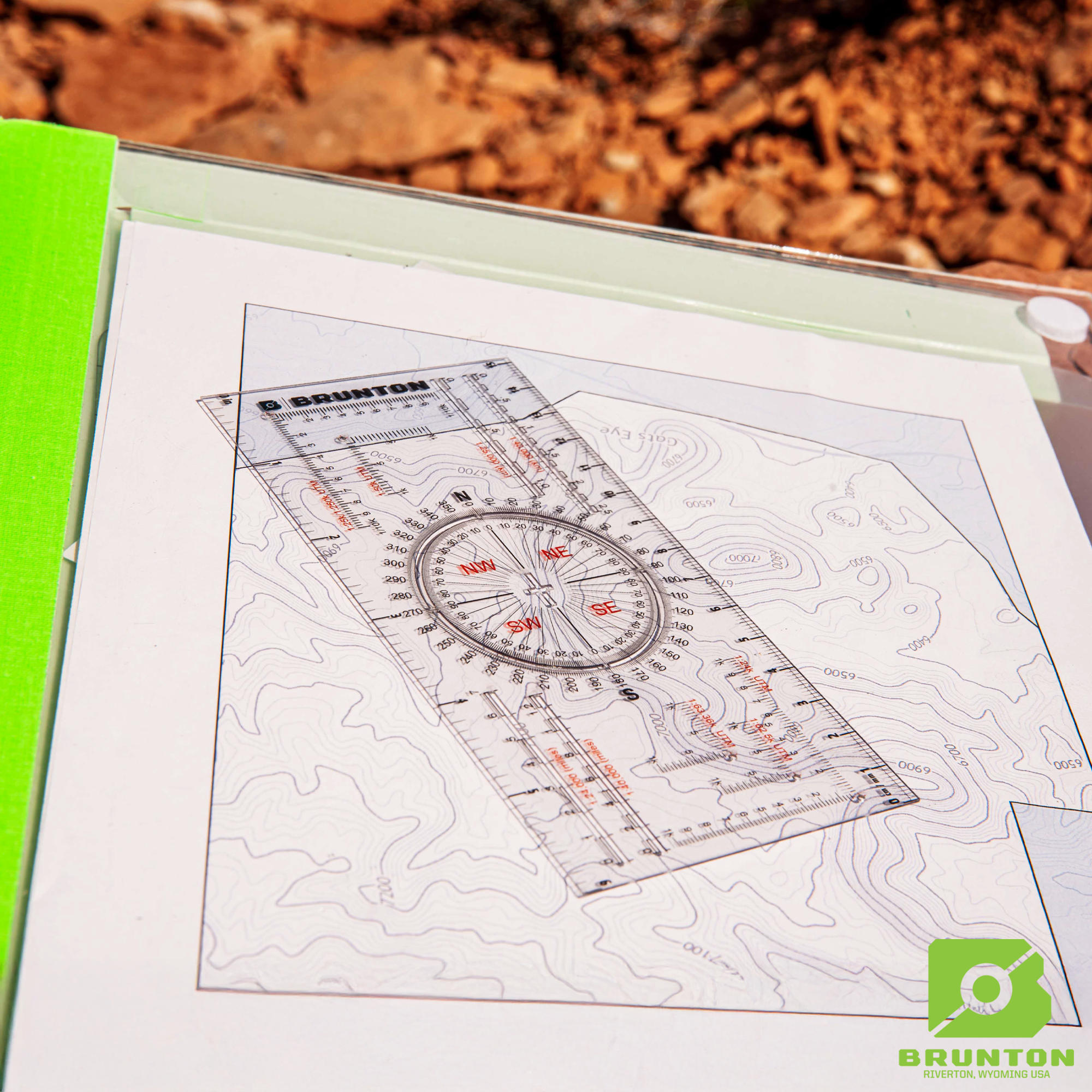
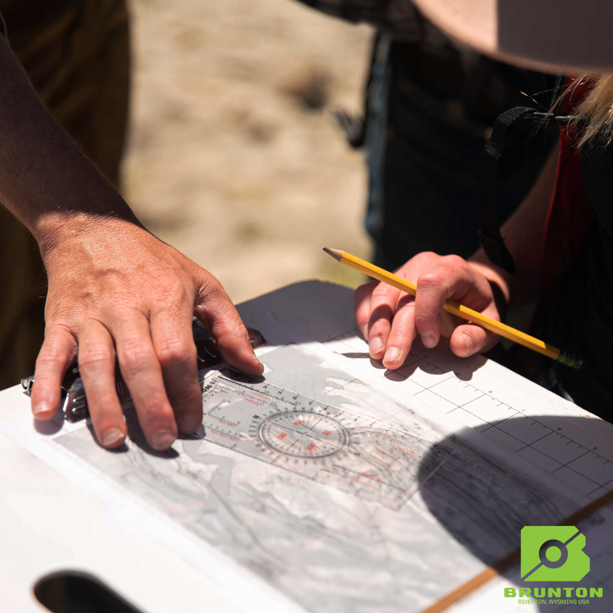
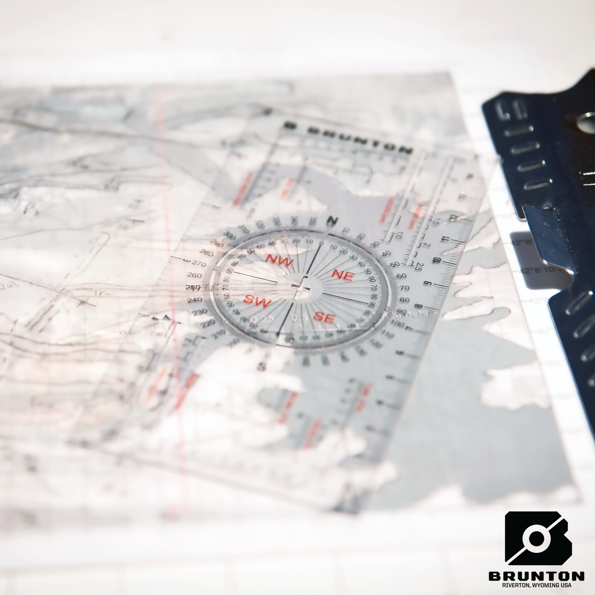
Designed for geologists, field professionals, and navigation enthusiasts, the Brunton Map Multi-Tool combines essential mapping and measuring functions into a lightweight, durable, and weatherproof card. Featuring rulers, map scales, UTM grids, and protractors, this multi-tool ensures precise plotting and measuring, making it an indispensable addition to your field gear.
Easily fitting into field pouches, vest pockets, or notebooks, this tool is perfect for on-the-go professionals who require quick and accurate map plotting in any environment.
Key Features & Benefits
-
Durable, Waterproof & Lightweight – Built to withstand all weather conditions.
-
Multi-Function Mapping Tool – Combines rulers, scales, grids, and protractors in one.
-
Precise Rulers in Metric & Imperial Units – Includes both cm/mm and inch/10ths rulers.
-
360° Protractor with Azimuth (0-360°) & Quadrant (0-90°) Markings – Ensures accurate angle measurements.
-
Romer Scales for UTM Grids – Works with multiple international map scales for precise plotting.
-
Unique Cutouts – Makes it easier to plot points, lines, and geological measurements.
-
Strike & Dip Crosshairs Cutout – Specifically designed for geologists to plot structural data.
-
Compact & Portable – Slips easily into your field pouch, pocket, or notebook for convenient storage.
-
Made in the USA – Precision-manufactured for accuracy and reliability.
Technical Specifications
-
Dimensions: 15.2 x 7.6 x 0.7 cm
-
Weight: 10.4 g
Estimer la livraison